Codrington (Codrington)
Codrington is a town located on the island of Barbuda, which is part of the country of Antigua and Barbuda. For travelers and visitors, Codrington is served by Barbuda Codrington Airport.
Codrington was founded by Christopher Codrington and his brother John in 1685, to be the main residential centre on the island. They built a castle which dominated the town, but it was badly damaged by an earthquake in 1843 and little trace of it now remains. It had a population of 914 in 2001.
In 1741, the first slave rebellion happened in Codrington. Beach's Rebellion arose as a consequence of manager Thomas Beach's "cruel and tyrannical" behaviour. Several herds of cattle were slaughtered, with additional damage being done to the Codrington's property and equipment.
The population of Codrington was recorded as 700 in the census of 1904, and 1,252 in the census of 1991. The town, along with the rest of the island, was completely evacuated in September 2017 following catastrophic damage caused by Hurricane Irma, but much of the population has now returned to the island.
Map - Codrington (Codrington)
Map
Country - Antigua_and_Barbuda
 |
 |
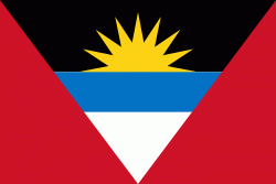
| Flag of Antigua and Barbuda | |
The country consists of two major islands, Antigua and Barbuda, which are approximately 40 km apart, and several smaller islands, including Great Bird, Green, Guiana, Long, Maiden, Prickly Pear, York, and Redonda. The permanent population is approximately 97,120 ( estimates), with 97% residing in Antigua. St. John's, Antigua, is the country's capital, major city, and largest port. Codrington is Barbuda's largest town.
Currency / Language
| ISO | Currency | Symbol | Significant figures |
|---|---|---|---|
| XCD | East Caribbean dollar | $ | 2 |
| ISO | Language |
|---|---|
| EN | English language |


